Events Calendar
Current Weather
McManus Lake Access Point (#21) 
Location
At a point 6.4 kilometres beyond the Sand Lake Gate, turn right (north) and proceed 8.3 kilometres to the south end of McManus Lake. Note that travel below McManus Lake on the Petawawa River is prohibited because of the military artillery range, and travel upstream is difficult beyond Whitson Lake. This access point serves chiefly as a pick-up spot for canoeists descending the Petawawa River from the Lake Travers Access Point. Latitude and longitude of Access Point: 45.945182°, -77.606144°
Facilities
- Parking
- Toilets
Backcountry Permits
Make a reservation for your backcountry camping permit up to 5 months in advance. Permits are only available online or via telephone.
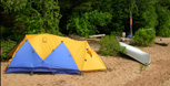
Equipment Rental
Do you need to rent a canoe, tent, or other camping equipment? Find a business that can supply some or all of the required equipment for your backcountry trip.
Water Levels
Check for special advisories prior to your departure at Algonquin Park Advisories.
Related Information
- Petawawa River Whitewater Guide
- Whitewater Canoeing - Petawawa River
 Sand Lake Gate
- Lake Travers Access Point
- Mallard (Sec) Lake Access Point
- Grand Lake - Achray Access Point
 Achray Campground
 Barron Canyon Trail
- Backcountry Canoeing
- Canoe Routes Map - Explore Online

Reserve your developed or backcountry campsite for your next visit.


Share your passion for Algonquin Park by becoming a member or donor.

Special regulations for Algonquin's special fishery.