Events Calendar
Current Weather
Highland Backpacking Trail 
 As of June 27, 2025, Ontario Parks has permanently closed the Highland Backpacking Trail Bridge over the Madawaska River. The rest of the trail remains open. Backpackers should reroute to the Old Airfield (near Mew Lake Campground), travel across the Old Railway Bike Trail Bridge at the Madawaska River, and then return to the backpacking trail using the the Old Railway Bike Trail, and then rejoin the trail to Starling Lake. This detour adds an additional 2.7 kilometres (one-way) to posted distances. No details concerning a temporary or permanent replacement bridge have been announced by Ontario Parks.
Description
- Highland Backpacking Trail is an overnight backpacking trail with loops of 19 and 35 kilometres in length. The challenging trail can be accessed from the Highland Backpacking Trailhead at km 29.7 of Highway 60 (near Bat Lake Trail).
Length
- 19 and 35 kilometre loops
Location
- Highland Backpacking Trail is located at km 29.7 of Highway 60.
- Latitude/Longitude: 45.573014°, -78.525263°
Operating Dates
- Open year-round
- See possible closures at Algonquin Park Advisories.
Difficulty Rating & Rationale
- Difficult. Steep climbs, side slopes and sharp turns.
Features & Amenities
- Parking
- Bathrooms
- Scenic lookouts
- Lakes and rivers
Trail Map
The Backpacking Trails Map of Algonquin Provincial Park is the essential trip planning map-brochure that outlines detailed routes, campsite locations, required equipment, how to make campsite reservations, and important safety information.
Backcountry Permits
Make a reservation for your backcountry camping permit up to 5 months in advance. Permits are only available online or via telephone.
Fees
A valid camping permit is required for trail use.
Equipment Rental
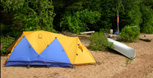
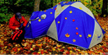
Do you need to rent a canoe, tent, or other camping equipment? Find a business that can supply some or all of the required equipment for your backcountry trip.
Nearby Attractions
 Bat Lake Trail
 Mew Lake Campground
- Two Rivers Trail
- Track and Tower Trail
 Old Railway Bike Trail
- Lake of Two Rivers Campground
- Hemlock Bluff Trail
Related Information
- Western Uplands Backpacking Trail
- Eastern Pines Backpacking Trail
- Backpacking Trails of Algonquin Provincial Park (map)
- Interpretive Walking Trails
Reserve your developed or backcountry campsite for your next visit.


Share your passion for Algonquin Park by becoming a member or donor.

Special regulations for Algonquin's special fishery.